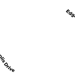
10 DECAROLIS DR
Owner Information
SURETTE STEPHEN A & LORI A
10 DECAROLIS DR
TEWKSBURY, MA 01876


Property Details
10 DECAROLIS DR is classified as a Residential Condominium (Condominium - 1%).
The primary structure on this property was built in 1983. There are 1,720ft2 of built area within this property. There is 1,023ft2 of residential/living space within this property.
10 DECAROLIS DR is valued at $285,900. The land is valued at $0 and the structures are valued at $283,700. There is an additional valuation of $2,200 on this property.
This property is in Zone MFD. Confirm with local Zoning Board authorities to ensure there are no overlays or other easements on this property.
The most recent deed for 10 DECAROLIS DR is recorded at the local registrar in Book 11420, Page 0306. 10 DECAROLIS DR was last sold on Thursday, March 8, 2001 for $1.
Assessment data from fiscal year 2021.
Flood Data
This property is partially within the AE Zone (within floodplain). Approximately 21.55 acres (62.62%) of the property is within this zone.
A portion of this property is denoted as being within a floodway.
This information is sourced from the FEMA National Flood Hazard Layer. See our full disclamer.
Broadband Internet Providers
| Provider | Type | Bandwidth (mbps) | |
|---|---|---|---|
| Verizon New England Inc. | DSL | 5 | 0 |
| Viasat Inc | Satellite | 100 | 3 |
| Verizon New England Inc. | Fiber | 940 | 880 |
| VSAT Systems, LLC. | Satellite | 2 | 1 |
| HughesNet | Satellite | 25 | 3 |
| GCI Communication Corp. | Satellite | 0 | 0 |
| Comcast | Cable | 1000 | 35 |
Broadband service provider data from December 2020.
Adjacent Properties
- 7 YOUNG ST
Single Family Residential owned by LEGERE CHARLES G & NANCY A - 57 YOUNG ST
Single Family Residential owned by FERRIN JAY S & CHRISTINA D - 45 YOUNG ST
Single Family Residential owned by LOWRY KEVIN F & DEBRA L - 37 YOUNG ST
Single Family Residential owned by CONLEY DAVID B & JEAN M - 61 YOUNG ST
Single Family Residential owned by TEMMALLO FAMILY REALTY TRUST - YOUNG ST
Undevelopable Residential Land owned by SUGHRUE HOLLY C - SHARON ST
(formerly Municipalities/Districts. Removed June 2009.) owned by TOWN OF TEWKSBURY - 116 TENTH ST
Single Family Residential owned by CONLEY ROBERT C & MARY JANE - TENTH ST/OFF
Undevelopable Residential Land owned by CONLEY R C & MARYJANE TR - 90 TENTH ST
Single Family Residential owned by EVANS JAMES J & DEBORAH L - 64 TENTH ST
Single Family Residential owned by OLEARY JEAN M - 96 TENTH ST
Single Family Residential owned by DEMARIO FRANK L & JENNIFER L - 110 TENTH ST
Undevelopable Residential Land owned by ROBERT C CONLEY, TRUSTEE OF TENTH ST RT - 106 TENTH ST
SFR INLAW/ RSTR 2ND UNIT owned by MASTROPIETRO JOHN J & STOKES JACQUELYN A - 113 TENTH ST
Single Family Residential owned by KLEROWSKI ROBERT - 79 EIGHTH ST
Single Family Residential owned by HINTON ALLEN R & PEARLINE M - 155 SEVENTH ST
Single Family Residential owned by CREEDON SEAN WILLIAM & DIANE SARAGOSA TR - 65 EIGHTH ST
Single Family Residential owned by GILES MARSHA L - 117 TENTH ST
SFR INLAW/ RSTR 2ND UNIT owned by ANDERSON THADDEUS S & LINDA S - 2131 MAIN ST
Developable Commercial Land owned by BTGOG LLC - MAIN ST
Undevelopable Commercial Land owned by SCOOTER PIE LLC - 2119 MAIN ST
Discount Stores, Junior Department Stores, Department Stores owned by SCOOTER PIE LLC - 2115 MAIN ST
AUTO REPR MDL-96 owned by AGB PROPERTIES LLC - 2087 MAIN ST
Fairgrounds and Amusement Parks owned by LBM LLC - 65 ARLINGTON ST/BEHIND
(formerly Municipalities/Districts. Removed June 2009.) owned by TOWN OF TEWKSBURY - 2171 MAIN ST
Discount Stores, Junior Department Stores, Department Stores owned by MAIN AND MARCH REALTY LLC - 2195 MAIN ST
Automotive Vehicles Sales and Service owned by NICKERSON RAYMOND P TR - 2185 MAIN ST
Discount Stores, Junior Department Stores, Department Stores owned by VITALE REALTY HOLDINGS LLC